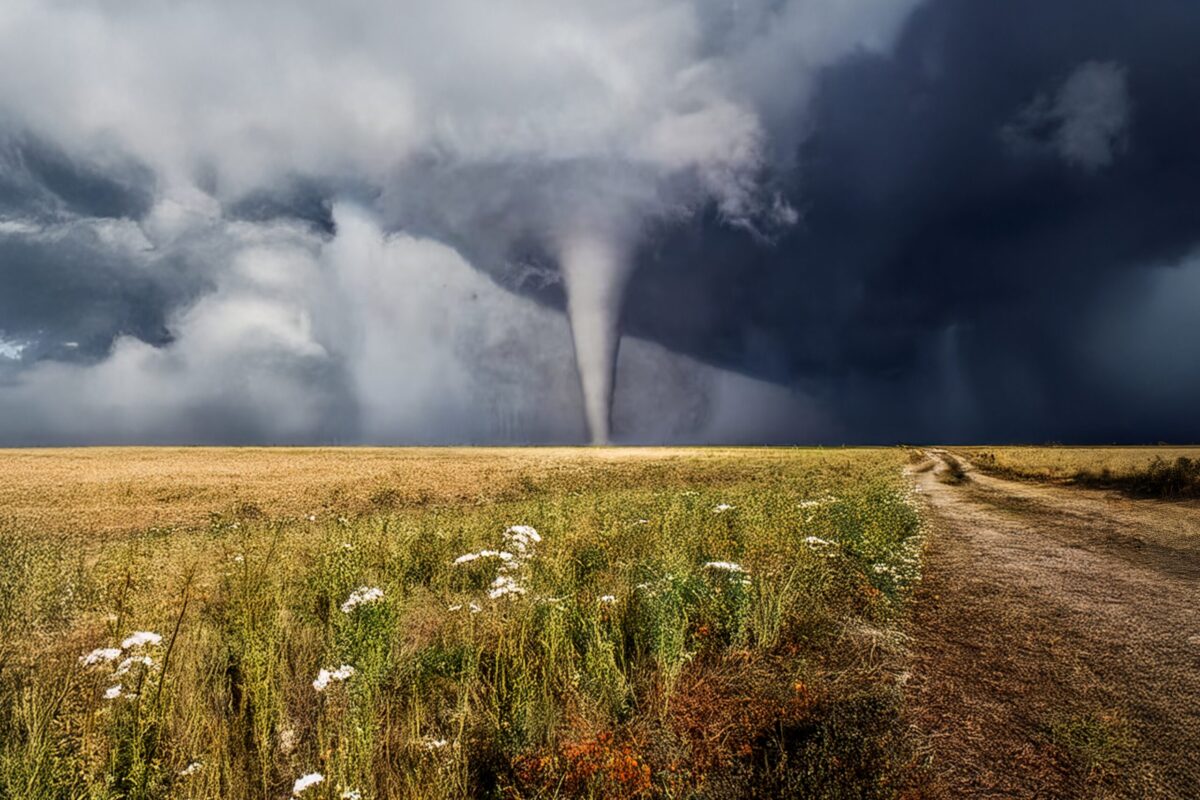
Many destructive tornadoes have touched down in Iowa in recent years. (Domenichini Giuliano/Shutterstock)
From historic floods to destructive tornadoes, discover extreme weather events in Iowa that were caught on tape (and watch the footage for yourself).
Extreme weather events are on the rise in Iowa—and across the globe. In 2024, Iowa saw a record-breaking number of tornadoes, and experts expect these events to increase in frequency and intensify in the years to come.
As a landlocked state, Iowa doesn’t have to contend with hurricanes or tropical storms like many coastal states do. However, other extreme weather events, such as tornadoes, thunderstorms, and flooding, are prevalent in the Hawkeye State. Additionally, Iowa experiences hot, humid summers and cold, snowy winters, during which the occasional blizzard isn’t uncommon.
Keep reading to learn more about some of Iowa’s most intense weather events and watch footage of them unfolding.
1. Iowa Tornado Outbreak of 2005
On November 12, 2005, a powerful storm system developed in Iowa. A total of 12 tornadoes touched down in the Hawkeye State, with three in particular noted for their intensity.
The strongest tornado, rated as an F-3, touched down in Stratford, where it destroyed homes, damaged the city park, and killed one woman. Another tornado—slightly less intense with an F-2 rating—touched down in Woodward, damaging homes and injuring some residents. A tornado sighting near Ames, home of Iowa State University, caused an evacuation of the school’s football stadium, where a game against the University of Colorado was scheduled for that evening.
2. Parkersburg Tornado
A historic tornado ripped through the south side of Parkersburg on May 25, 2008. The tornado had wind speeds that exceeded 200 miles per hour and caused more than 40 miles of damage, killing seven people and destroying almost 300 homes.
The Parkersburg tornado was given an EF-5 rating—the equivalent of an F-5—making it the first tornado of this size in Iowa since 1976. (In 2007, the Fujita Scale was replaced with the Enhanced Fujita Scale, changing tornado ratings from F-scale to EF-scale.)
3. Floods of 2008
Tornadoes, although fairly common, aren’t the only extreme weather events to plague Iowa. In June 2008, parts of eastern Iowa experienced historic flooding caused by multiple heavy rainfall events. The Cedar River crested to its highest level in history—about 31 feet. Flood waters penetrated about 14 percent of the city, damaging about 5,390 homes and dislocating more than 18,000 residents.
At the time, damage caused by the floods and corresponding tornadoes was considered the sixth-largest FEMA disaster declaration based on estimated financial public assistance ($848 million).
4. Blizzard of 2009
There have been several headline-making blizzards in Iowa’s history, including one on December 8, 2009, that dumped between 8 and 17 inches of snow on Iowans, depending on where they lived. The statewide average snowfall amount of 10.2 inches became the third-highest on record in Iowa. Snow drifts buried cars, and with the storm’s high winds (gusts up to 50 miles per hour), the wind chill dipped to 30 degrees below zero in some parts of the state.
5. 2020 Midwest Derecho
A derecho—a widespread, long-lasting wind storm associated with rapidly moving thunderstorms or rain showers—swept through Iowa on August 10, 2020. Winds reached up to 140 miles per hour—nearly double the typical speed for a derecho—and lasted for about an hour. Almost every building in Cedar Rapids suffered damage from the storm, and as many as 25,000 Iowans were without power for 10 days after it hit.
The derecho, dubbed the 2020 Midwest Derecho, primarily impacted Iowa, but it also caused damage in Nebraska, Illinois, and other Midwest states. The damage is estimated to total more than $11 billion, making it the costliest thunderstorm in the U.S.
6. December 2021 Derecho
Another derecho hit Iowa on December 15, 2021, causing widespread damage estimated at around $2 million. The derecho caused record-high temperatures, up to 75 degrees in some parts of Iowa, and 63 tornadoes, also a record high.
To be considered a derecho, a storm must produce multiple wind gusts greater than 75 miles per hour, have a damage path more than 50 miles wide, and have a wind damage path of more than 250 miles. The storm that hit Iowa on December 15 met all of these criteria.
7. Iowa Tornado Outbreak of 2024
On April 26, 2024, 29 tornadoes tore through Iowa—the most the state had experienced in a single day since the 2021 derecho mentioned above. The storm system started in Nebraska and moved into Western Iowa. Three EF-3 tornadoes formed in Pottawattamie County, with winds exceeding 160 miles per hour. One of the EF-3 tornadoes touched down in Minden, destroying about half of the town’s homes and the majority of its businesses. Later that evening, multiple EF-2 tornadoes touched down across south-central Iowa. At least one person was killed, and multiple other injuries were reported.
April 2024 broke a state record with 49 tornadoes recorded in the month. (The previous record was 40, recorded in 2001.)
Pro tip: If you’re worried about a tornado touching down in your area, it can help to know the signs of one so you have time to prepare and get to safety. According to the CDC, the following are all signs that a tornado may be approaching: a rotating, funnel-shaped cloud; a cloud of debris; a dark or green-colored sky; a large, dark, low-lying cloud; large hail; and a loud roar that sounds like a freight train.
8. 2024 Greenfield Tornado
Not long after the April 2024 tornado outbreak, another devastating tornado ripped through Iowa. On May 21, an EF-4 tornado made its way across south central Iowa, hitting the community of Greenfield especially hard. With peak wind speeds of 185 miles per hour, the tornado caused significant damage, injured 35 people, and resulted in the death of five.
Several other tornadoes formed in the state after it experienced a number of thunderstorms, heavy rainfall, and flash flooding; however, they were much less devastating than the one in Greenfield.
9. Hailstorm of 2025
There has been no shortage of storms in Iowa this year, with one on April 17 producing baseball-sized hail and two tornadoes. The first tornado was a confirmed EF-1 tornado with an unusually large width—about 1.78 miles—and winds that reached up to 110 miles per hour. Hail with a diameter of about 2.75 inches was also recorded during the storm.
The storm touched down in southwest Iowa near Imogene, where the most damage was sustained, and then moved into Essex. The second tornado, rated an EF-0, touched down near Tabor. With winds up to 60 miles per hour and a width of about one-quarter mile, the tornado caused minor damage.
10. Quad Cities Tornadoes
One of the most recent noteworthy weather events to hit Iowa is a series of at least three tornadoes that tore through the Quad Cities region on July 11. A multi-vortex, EF-2 tornado struck the La Motte area, with a maximum speed of about 120 miles per hour. This tornado damaged multiple farm buildings and ripped the roof off of at least one home.
Another tornado, an EF-0 with a maximum speed of about 85 miles per hour, passed through LeClaire and caused minimal damage.
An additional tornado, an EF-2, developed southeast of Blue Grass before moving into Davenport. With a maximum speed of about 120 miles per hour, this tornado caused considerable damage to several businesses, including Camping World and Emeis Golf Course.
Heavy downpours and flash flooding were also reported during the tornadoes.

Gov. Reynolds announces programs to fund recovery for victims of state floods, tornados
Following a summer of disastrous floods and tornadoes, Gov. Kim Reynolds announced multiple new programs to help impacted farmers and citizens...

What Summer Was Like The Year You Were Born (For Anyone Younger Than 103)
For most Americans, memories of childhood summers conjure images of pool parties, beach outings, long days, and warm starry nights. Even though you...
No Results Found
The page you requested could not be found. Try refining your search, or use the navigation above to locate the post.


